Credits
CityLayers: London is built on other people's careful work: 3D scans of buildings and objects that still survive, and generations of archaeology and historical research.
3D scans
These models are used under the Creative Commons Attribution 4.0 International licence. Each has been modified (scaled, cropped, simplified) to fit the reconstruction and run on an iPhone or iPad.
Archaeology and history
The places in each layer come from published sources, including the Museum of London Archaeology (MOLA), the Survey of London, British History Online, the Agas map of London and Wikipedia. Each source is cited place by place inside the app, on the card for that place.
Where a building's size or shape is a reconstruction rather than a record, the app says so.
The 1572 map and the app icon
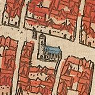
The app icon is a detail of the City's streets, around Cheapside, from Braun and Hogenberg's map of London, Londinum Feracissimi Angliae Regni Metropolis, in Civitates Orbis Terrarum (1572), from a hand-coloured copy (Altea Gallery), in the public domain.

The map appears behind the home page's opening, in the share image and at the end of the film, reduced in size but not recoloured.
Historic maps and records
The layers were measured against these maps and records, fitted to today's streets. None of the map images is shown in the app; the streets, river edges and buildings drawn from them are our own work. The app's How we made this page explains the method and the measured errors.
- Ordnance Survey 1:1056 town plan of London, 1891–95
- Ogilby and Morgan, A Large and Accurate Map of the City of London, 1676
- John Rocque, A Plan of the Cities of London and Westminster, and Borough of Southwark, 1746
- The ‘Agas’ map of London, c. 1561 (1633 edition)
- Historic England, National Heritage List for England
- Map of Early Modern London gazetteer, ed. Janelle Jenstad, University of Victoria
- MOLA, location plan of the first Roman forum (Historic England, 2025)
- Wyngaerde, panorama of London, c. 1544; Hollar, Long View of London from Bankside, 1647
Old pictures on the place cards come from Wikimedia Commons; each shows its maker, date and licence beneath it in the app.
Map data
Map data © OpenStreetMap contributors, available under the Open Database License (ODbL), where used. Map tiles in the app are provided by Apple MapKit.
Typefaces
This site is set in Newsreader by Production Type, Figtree by Erik Kennedy and IBM Plex Mono by IBM, all under the SIL Open Font License.